The post US West in a week. Yosemite and Sequoia National Parks appeared first on Vi Travel Tips.
]]>Yosemite National Park is located ~300 km (190 miles) east of San Francisco and it takes about 4 hours to get there, so it is better get up as early as possible. Actually it applies to any day of this itinerary. Sorry, there is no time to sleep during this week J
The entrance fee to Yosemite NP is $20 per car and includes all occupants of the car. Permit is valid for unlimited entries to the park for 7 days. Because during this week it will be visited at least 4 national parks the best deal is to buy Annual Pass. It cost $80 for all National parks and you can buy it before your trip online.
Yosemite National Park is huge. The area of the park is ~3100 square km (~1200 square miles) with over 1200 kilometers (750 miles) of trail. Yosemite Valley is the best place to go for day visitor. Surrounded by up to 1.5 km (5,000 feet) rocks the valley itself is very flat and it is possible to take some short hikes without proper hiking boots.
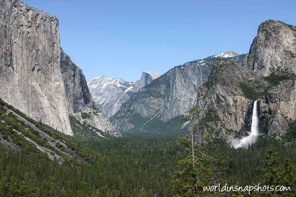
Some short hikes to choose:
- Bridalveil Fall – 800 meters (0.5 miles) round-trip, 20 minutes
- Lower Yosemite Fall – 1.6 km (1 mile) loop. 30 minutes
- Cook’s Meadow Loop – 1.6 km (1 mile) loop. 30 minutes
- Mirror Lake/Meadow – 3.2 km (2 miles) round-trip, 1 hour
- Vernal Fall footbridge – 2.6 km ( 1.6 miles) round-trip, 1.5 hours
May is the best month to watch water falls then snow melts in the mountains. You won’t see so much water in August as you can see in above photo.
Next stop is at Sequoia National Park (entry fee is $20 if you didn’t buy Annual Pass). Park is 300 km (190 miles) and 4 hours driving away from Yosemite Valley, but you must to see those giant trees and largest is the General Sherman Tree. The tree is 84 meters (275 feet) height and estimated 2300-2700 years old and is called the largest living thing on the Earth.
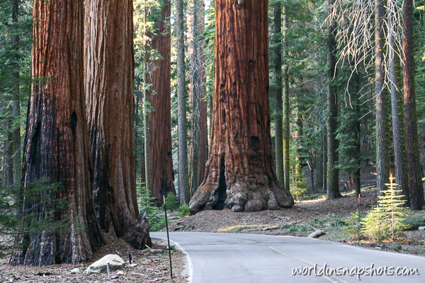
The tunnel log located not far from the General Sherman Tree will let you feel even more how big these trees are as you can drive with your car through that tunnel.
It will be later evening by the time you reach this tunnel and the close by Mono Rock is the best place for sunset viewing – with sun going down in the west and moon rising above Great Western Divide in the east .
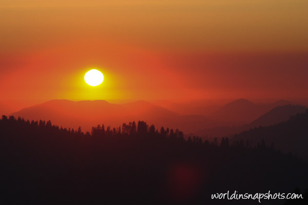
A view is fantastic and at least during my visit it wasn’t many people there at night so maybe you can enjoy that view only by yourselves.
Sun goes down and it is time to look for overnight stay. Bakersfield is largest town on the way. There are plenty of motels there, so I think it is best place to spend a night before heading to Death Valley tomorrow.
The post US West in a week. Yosemite and Sequoia National Parks appeared first on Vi Travel Tips.
]]>The post Climbing Mount Augustus, the largest rock in the world appeared first on Vi Travel Tips.
]]>Usually Uluru or Ayers Rock is often called as world’s largest rock. But in fact Uluru is more then 2 times smaller size comparing with Mount Augustus.
I am sure somebody will start argue it is different type of rock. One is monocline and another is monolith. I am not planning be involved in such discussion, but you can check this talk on wikipedia if you are interested.
How big is Mount Augustus
Mt. Augustus, or Burringurrah as local aboriginals call it, raises 1106 meters ( 3629 feet) above sea level. It is 8 kilometers (5 miles) long and 3 kilometers (1.5 miles) wide.
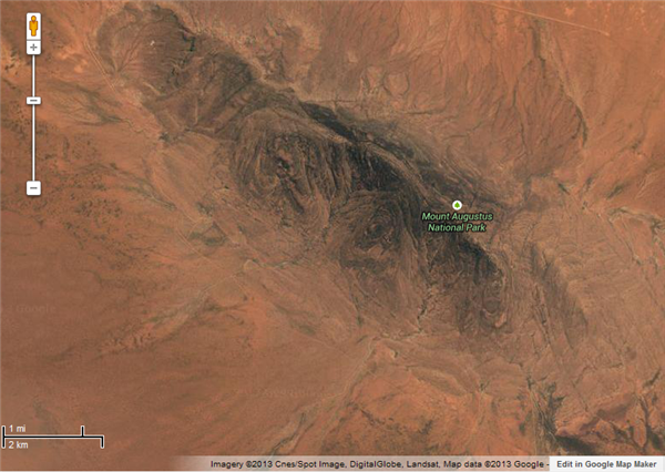
Circumference of Mt August is about 30 kilometers (~16 miles). For comparison Uluru circumference is slightly more then 9 kilometers (~6 miles). There is no base walk, but you can take 49-kilometer drive around the rock with access to some creek gorges and Aboriginal rock engravings.
Where is Mount Augustus located
Getting there is one of the exciting parts of the trip to Mount Augustus. It is very remote place. Nearest city, Carnarvon, is located 430 kilometers (~270 miles) West from the mountain and 360 kilometers (~225 miles) East there is small town – Meekatharra.
View Mt Augustus in a larger map
I was driving from Meekatharra to Mount Augustus and then to Carnarvon and most of the road was unsealed, but it was good enough to drive my small 2WD camper van.
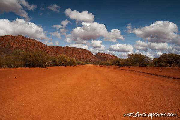
Of course it is better to check latest information about roads condition on Main Roads Western Australia website, as some roads can be closed or in bad condition and not suitable for campervans or 2wd cars.
As you understand it is remote place so you must carry plentiful of fuel, water and supplies. There is fuel at Mount Augustus Outback Tourist Park and in Cobra, but gas prices are almost 50% higher what you would pay in Perth or Carnarvon. In Cobra I found probably most expensive fuel in Australia.
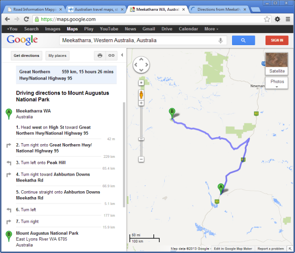
There is one interesting thing I found during preparation for this trip. Google Maps couldn’t show you direct route to Mt Augustus from Meekatharra. It is already couple years passed since my trip, but Google Maps still shows you wrong route.
Here is Google Maps:
and here is Bing maps suggestion:
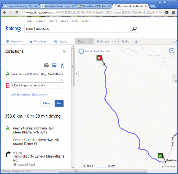
I wouldn’t mind if it would be couple km difference, but in this case it is additional 200km (125 miles) and 5 hours more driving. So it is better to use Bing Maps for online route planning.
Duration of the trip is another important thing to note. All online route planners and GPS applications take average speed 30km/h (20miles/h) if route goes on unpaved road. That is why it shows almost 11 hours driving. In reality it took 5.5 hours for me to get from Meekatharra to boundaries of Mt Augustus National Park. So actually it was ~60km/h (38miles/h) average speed.
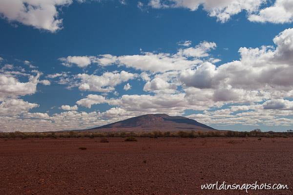
I did get up early in Meekatharra and at midday was near the mountain.
Climbing Mount Augustus
There are two trails to the Mt Augustus summit: one is called Summit trail (class 4) and another is Gully Trail (class 4/5). Both trails are 12 km (7.5 miles) return. After first 3 km (2 miles) Gully trail links into Summit trail, so only first part of Gully trail is more challenging trail and park’s guide recommends additional hour each way if somebody choose Gully trail (marked in green colour in map bellow).
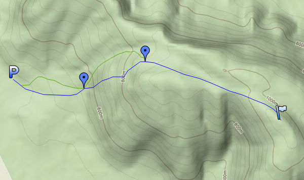
According DEC brochure it takes average 6 hours return on Summit trail and 7 hours return on Gully trail.
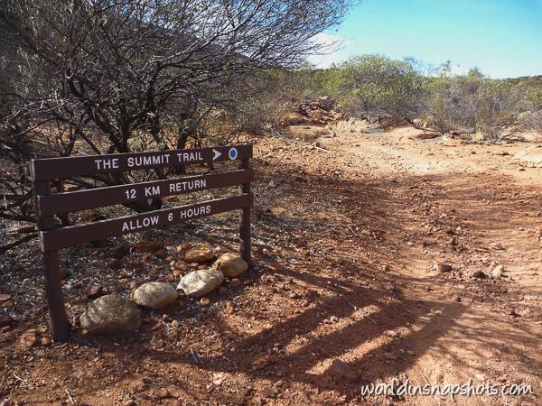
It is easy to calculate how much time you will need on the trail if you did any trekking on other national parks. I usually recommended time divide by 2, so expected to spend ~3 hours on Summit Trail and that was very accurate assumption.
In my opinion it is quite easy trail except one part. Here is trail’s elevation profile:

The total vertical elevation of the trail is 650 meters (2133ft). Trail stars at very gentle gradient. After 1.5km (1 mile) the steepest climb starts. In next 1.5 km(1 mile) trail goes up 350 meters (1150ft) and then again it will gentle gradient with short steeper part just before the summit. It will take only 1.5 hours and you will be on the top 
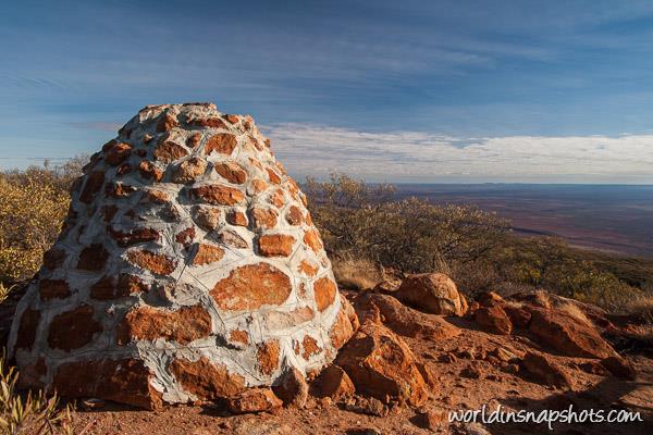
And enjoy view of endless plains from the summit:

It was no other people on the top and I could enjoy the view just by myself. I was happy I did this climb and didn’t climb Uluru rock. Really why should I climb most pretty rock (Uluru) then I still can climb largest rock in the world instead?
P.S. In winter temperature is not such high at Mount Augustus National Park, but it still reach average 25C (77F) and with clear skies it can be really hot. So it is better to climb in the early morning. I started my climb at dawn and may be that helped to reach summit faster.
The post Climbing Mount Augustus, the largest rock in the world appeared first on Vi Travel Tips.
]]>The post Activities to pursue in the Canary Islands appeared first on Vi Travel Tips.
]]>As one of the most beautiful sets of islands in the world, the Canaries are visited by millions every year. Not only are they part of the lost islands of Atlantis, but they also hold great historical significance too; Hercules collected his golden apples in the Canary Islands. For thousands of years, these islands have been shrouded in myth, however as amazing they are in ancient literature and fable, they’re even more impressive in real life.
Located just off the coast of Morocco, these seven islands are also of great geological interest. Sometime in the last 40 million years, the tectonic plates under the sea bed shifted, causing mass volcanic eruptions. These eruptions, once the lava solidified, saw massive volcanoes form, which are now the range of mountains seen across the Canaries.
The island used to be the home of travellers and missionaries looking for a safe haven on their way to exploring the New World, however these people have been replaced by culture-seeking tourists looking to bask in the sun, and experience the wonders these islands have to offer. Let’s take a look at some of the best activities the Canary Islands have to offer.
Hiking
There are a range of activities to experience when holidaying on the Canary Islands, however hiking is one of the most popular. Climbing a volcano can be a very gratifying thing to do, and with the amazing views from the top, it’s obvious why so many people choose to find the hiker in them. Experience is recommended however, and hiking one of the many volcanoes in the Canary Islands is not for the faint of heart – or the unfit.
Mount Teide, the tallest mountain in Tenerife, is one of the biggest climbs in the Canary Islands, taking over five hours of solid walking to reach the peak. At 3718 meters (12198 feet), the summit can get very steep at points, and you’ll have to navigate large boulders and solidified lava formations on your journey.
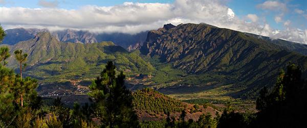
La Palma is also a great hiking spot, and it offers over 960 kilometers (600 miles) of walking trails for all levels of hiker. These trails take you straight though the heart of the volcano range, with forests, waterfalls and tough terrain all along the way. One of the best hikes to experience is the La Caldera de Taburiente National Park, and it is ideal of experienced walkers. Visit cruise.co.uk for great deals to the Canary Islands.
Scuba Diving in the Canaries
Every once in a while, mother nature throws a climate temper tantrum over the Canary Islands, and the sea bed can be dramatically reshaped when earthquakes occur. This makes scuba diving one of the most popular activities on the island, and there is even a stretch of sea bed that has been declared a UNESCO Marine Reserve.
As you descend though the crystal clear waters, you’ll be able to see the spectacular marine life that live in the Canaries, and from stingrays and turtles to globefish, there are some spectacular sights to behold.
The post Activities to pursue in the Canary Islands appeared first on Vi Travel Tips.
]]>The post Nepal is banning solo trekking? appeared first on Vi Travel Tips.
]]>
July, 2012
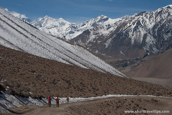
Two years ago TIMS card fee was introduced and now Trekking Agencies Association of Nepal (TAAN) want to force hikers to hire porters or guides no matter you need it or not.
In July TAAN announced about mandatory support staff (porter or guide) for all tourists traveling to any trekking destination In Nepal from September.
Trekking Agencies Association of Nepal has welcomed the decision and urged the government to include the decision in the Tourism Act for effective implementation. “The decision will help promote Nepal as a safe destination for tourists at a time when international media are questioning the safety of foreigners in Nepal,” Mohan Lamsal, general secretary of TAAN, said.
Of course they welcomed it, but they forgot it can be against them, as a lot of people already are thinking are they really want to go to Nepal to see Himalayas? May be instead to choose much cheaper Ladak region in India?
The reason for such rules?
Increased crime in the trekking areas
In last years it was couple assaults against young women in Langtang National Park with latest this June. But I doubt the guides or porters can prevent such accidents.
It always was hard to find good guide/porter in Nepal as the quality of guides and porters, even those who are TAAN registered, varies enormously. What will happen if it would become mandatory? It will be chaos and bad guides/porters will ruin all trekking business and it definitely won’t make trekking more secure. Even the best guide is not able to watch everybody as even in the small group people are hiking 100s meters apart and nobody can’t see what is happening around the corner. So I am sure the safety is not the first thing TAAN members are thinking when they pressuring the Nepali authorities to make these changes.
According to trekking operators, the new policy change will increase budget of FITs(Free Independent Travellers) by only around $10 per day.
Are they kidding? The porters hire price starts from $10. They forgot about food, transportation, agency tax. It will be at least double that. So hiker no should add (minimum) additional $100 for their weekly budget.
August, 2012
It good I double checked the information posted on TAAN website and found discussion in one of Lonely planet forums. Apparently all these announcements about mandatory guides/porter were only rumors spread by TAAN. I thought it is trusty body, but I won’t trust the information on their website without confirmation from other sources anymore. Thought they posted about government decision to put the ban of solo trekking on hold.
The post Nepal is banning solo trekking? appeared first on Vi Travel Tips.
]]>The post Lake O’Hara. Most beautiful day hike in Canada appeared first on Vi Travel Tips.
]]>
Next time I would love to go there with tent as there so much more to see and you can camp in backcountry. But you can still see a lot even if you have only one day.
For one day visit I suggest combine two trails – Lake Oesa Trail and Opabin Plateau Circuit.
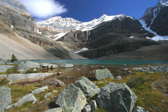
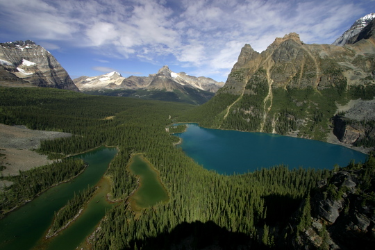
The combined trail length probably will be less then 8-9km (5-6 miles) with maximum 240-250 meters (800ft) elevation gain. This allow you to see O’Hara and Mary lakes from above (first picture) and to visit Lake Oesa with Rocky Mountains behind it (second photo), visit Opabin Plateau with some smaller lakes and come back down to lake O’Hara.
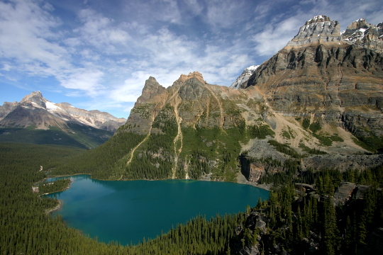
Doesn’t it sound like perfect day in the mountains with easy hiking? There is one very important thing – you must prepare for this trip in advance. I am not talking about physical training, but visitor number restrictions may be is one of beauty of this park as you don’t see big crowd there thought park is only 200km (130 miles) from Calgary or only 30km (19 miles) from Lake Louise in Alberta.
But these restrictions means you need to make a reservation well in advance for a seat in the bus. At moment only 42 day visitors are allowed. Of course you can hike the 11 kilometers access road from car parking to lake O’Hara, as there is no limit how many people can get to the lake on foot. But access road is not pictures at all and I would avoid hiking that road.
Check this page for bus seat reservation and other latest information about access to the park.
The post Lake O’Hara. Most beautiful day hike in Canada appeared first on Vi Travel Tips.
]]>The post Nepal TIMS Card is not free any more appeared first on Vi Travel Tips.
]]>The post Nepal TIMS Card is not free any more appeared first on Vi Travel Tips.
]]>The post How much does it cost trekking in Nepal appeared first on Vi Travel Tips.
]]>Cheapest option is independent trekking. In this case you need about 10-15$US/day. Bed in guest houses cost about 2-3$US/night and other expenses are for food. But depending on season and the size of group you are travelling with it is possible to negotiate and stay for free, but you must order food in guest house you are staying. This is possible during low or shoulder season when there not so many trekkers in the mountains. Prices in the cities like Kathmandu or Pokhara are much higher. Expect to pay at least 15-30$US per night for double room in guest house or hotel.
For 10-15$US/day you can hire porter if you feel your backpack is too heavy to carry it all the way. Just make sure to hire porter from reputable company. Can’t recommend any as I didn’t use any myself, but I heard stories how porters leave clients in the middle of trek or stealing stuff from backpack they are carrying.
Organized tours are most expensive option as you can expect. Prices starts from 50-100$US/day depending on trek. There are too many companies organizing tours so it is difficult to summarize all services they offer.
The post How much does it cost trekking in Nepal appeared first on Vi Travel Tips.
]]>The post Key Summit trail. Short trails in New Zealand appeared first on Vi Travel Tips.
]]>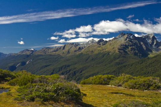
The best time to walk there in my opinion is in afternoon as at that time sun very nice lightens Southern Alps.
View Hiking in New Zealand in a larger map
So if you are going Milford Sound cruise in the morning, on your way back stop in The Divide car park where trail starts. There also begins Routeburn Track, but after you pass beech forest Routeburn and Key Summit tracks will split. Track is well signed and there is no way to get lost there. It takes about 40-60 minutes one way to get to summit and I would grade it as easy walk comparing with Lake Marian track
Some more photos from Fiordland in New Zealand
The post Key Summit trail. Short trails in New Zealand appeared first on Vi Travel Tips.
]]>The post Lake Marian track. Short trails in New Zealand appeared first on Vi Travel Tips.
]]>
View Hiking in New Zealand in a larger map
It is not easiest walk as track is steep in some places and can be muddy after rain, but it takes less then an hour to reach the lake and you’ll be rewarded with view to beautiful alpine lake surrounded by mountains.
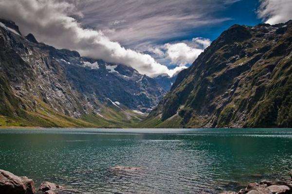
Water even in summer is quite cold but is very refreshing if you’ll be keen to swim in hot day.
Here are more pictures from Fiordland in New Zealand and information about other short walks in South Island, New Zealand.
The post Lake Marian track. Short trails in New Zealand appeared first on Vi Travel Tips.
]]>