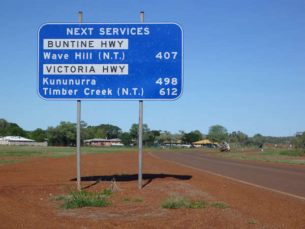
During my stay in Sydney I was planning trip to Western Australia for an swimming with whale sharks adventure and run into unexpected problem. I was heading to Exmouth which is located proximately 1300 kilometers (800 miles) north of Perth. It takes almost two full days to drive there, but I like driving so that wasn’t problem. The problem was gas station(or service) locations. That part of Western Australia is not very populated. There are no villages or towns and only scattered road houses on the route. Road houses are 200-250 km (120-160 miles) apart from each other.

When I was renting car in Europe, US or Canada, I never did think or care how much fuel I can fill into car tank. Usually was no problem to find gas station near by. But it didn’t work in this case. Thought I was renting smallest campervan it still was using about 15 liters of fuel per 100 kilometers and with 55 liters tank I could drive maximum 370 kilometers (230 miles). It meant I needed to stop at every road house for refueling and I had carefully to check any side trips I wanted to take. Did I have enough fuel to get back on road.
When you know your tank capacity and how much fuel your car uses per 100 kilometers or miles it is easy to calculate an distance you can drive. But I created this calculator to make it even more easier.
Rental companies provides all data you need to calculate it and it is important to know how far you can go with your car in such remote places. It makes you to look to your road trip planning with different approach. Can you reach every place with your car without auxiliary fuel tank. I hope this calculator will help you with your next road trip planning in Australia.

Leave a Reply